
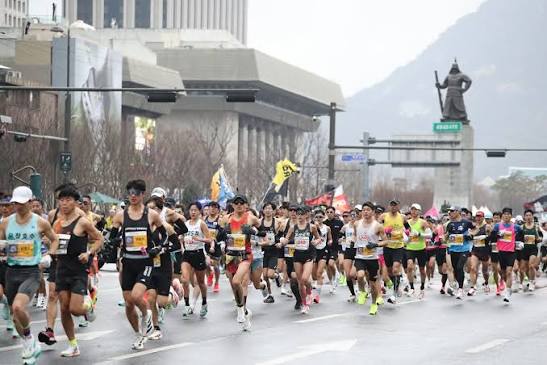
Seoul Marathon 2027
RunningGwanghwamun Square to Jamsil Seoul Korea
The course
First thirdMiddle thirdFinal third
Race distance
42.2km
WhereGwanghwamun Square to Jamsil Seoul Korea
SurfaceRoad
Elevation range–
Our GPS recording–, by Gary Eng
StartElevation along the courseFinish
Race categories
42.195 km10 km
Race morning
Dawn temperature in race week, the last 10 years
The average daily low across the week around race day. The dashed line is a typical Singapore dawn.
Source: Open-Meteo historical weather (ERA5). Singapore's typical dawn is its average daily low, 24°C (2021–2025).
Our coverage
More races around these dates
28Feb
SunOsaka Marathon 2027Osaka Castle Park07Mar
Sun42nd Miura International MarathonMiura City (Kanagawa)07Mar
SunTokyo Marathon 2027Tokyo07Mar
SunKagoshima Marathon 2027Kagoshima City and Aira City (Kagoshima)14Mar
SunNagoya Women's Marathon 2027Vantelin Dome Nagoya14Mar
SunTokushima Marathon 2027Tokushima City, Aizumi Town, Kitajima Town Naruto City (Tokushima)21Mar
Sun2XU Compression Run 2027F1 Pit Building21Mar
SunMetasprint Series : Triathlon 2027East Coast Park Car Park E
About this race
When is Seoul Marathon 2027?
Seoul Marathon 2027 is on Sunday 21 March 2027, in Gwanghwamun Square to Jamsil Seoul Korea.
How do I enter?
Entry runs through the organiser. Start at the official site and check it for registration dates, prices and any ballot.
What distances are there?
42.195 km, 10 km.
What is the course like?
The race distance is 42.2km on a road course. The map above is drawn from our own GPS recording of the route, which you can download as a GPX file.